VOYAGE OF DISCOVERY

Edward Bransfield’s pioneering voyage of discovery of 1819/1820 was the result of a chance encounter on the high seas almost a year earlier by Captain William Smith, a merchant seaman in command of the cargo ship, Williams.

Smith was taking Williams around Cape Horn in February 1819 on a journey from Buenos Aires to Valparaiso, Chile. In search of more favourable winds to the south, Smith sighted uncharted land at latitude of 62° 15’ S.

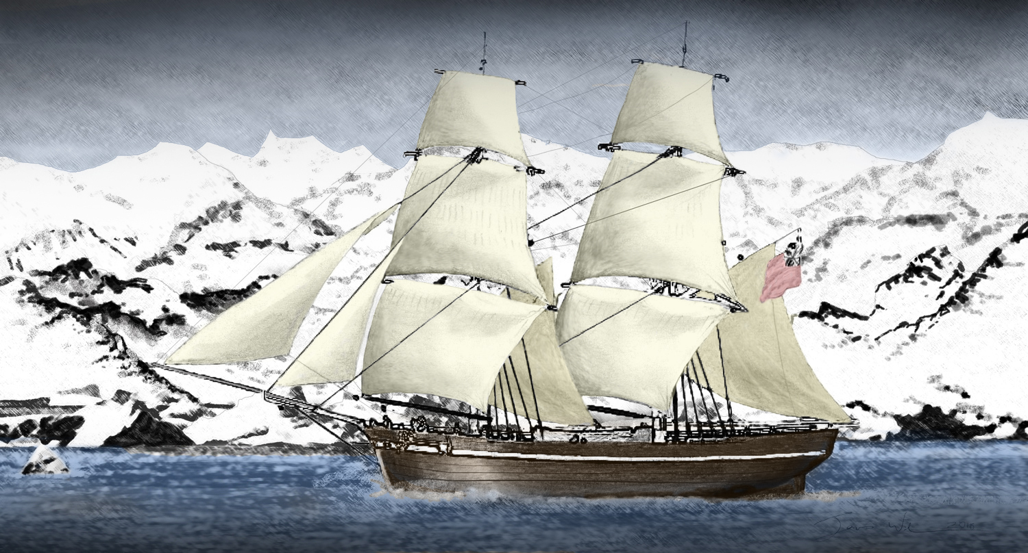
Artist’s Impression of  the ‘Williams’ of Blyth
Antarctic Peninsula, 30th January 1820,
by our Committee Member,
Jim Wilson © 2017

In accordance with protocol, Smith reported his findings to Captain William Henry Shirreff, of HMS Andromache and the British naval station in Valparaiso, Chile. However, Captain Shirreff was not convinced and Smith was unable to locate the territory on his return to Montevideo a few months later. Smith was more fortunate on his third voyage around the Horn to Valparaiso and on 15th October 1819 the land was clearly visible. Two days later, Smith took a small party ashore and named the territory New South Britain. Today the land forms part of the chain of South Shetland Islands, a necklace of 11 major islands and numerous small ones stretching for close to 300 miles (482 kilometers).

Smith was greeted with more enthusiasm when he docked at Valparaiso on 24th November 1819. Shirreff moved quickly, taking the Williams on charter and assembling a Royal Navy team to investigate Smith’s discovery. Edward Bransfield, a qualified ship’s Master with 16 years Royal Navy service, was appointed to lead the expedition.

Brig WILLIAMS CHARTERED BY CAPTAIN SHIRREFF

Williams, a small two-masted brig of just 216 tons and about 25 metres in length, sailed on 19th December 1819 with Smith, his crew of 24 and four Royal Navy officers under the full command of Edward Bransfield. The Williams was provisioned for a year and the logbook of HMS Andromache, Captain Shirreff’s ship, said of the Bransfield expedition:

“…go on a voyage of discovery towards the South Pole.”

Bransfield’s instructions were to locate and map any new territories and to take possession for King George IV. He was also ordered to observe any wildlife and inhabitants and collect specimens of rock and wildlife they encountered. Finally Bransfield was ordered to “conceal every discovery that you have made during your voyage” and to keep a “secret journal” to hand over to Captain Shirreff on his return.

The 2,000 mile (3218 Kilometre) journey from Valparaiso to the South Shetlands was fraught with danger for the small vessel which had not been strengthened against the ice and had sailed without a support ship in notoriously turbulent seas where cross currents and high winds are a constant threat. It took nine days to travel the first 6 miles (9.6 K) alone because of the poor conditions and banks of swirling fog closed in as Williams entered the fearsome waters of the Drake Passage.

DISCOVERY OF ANTARCTICA

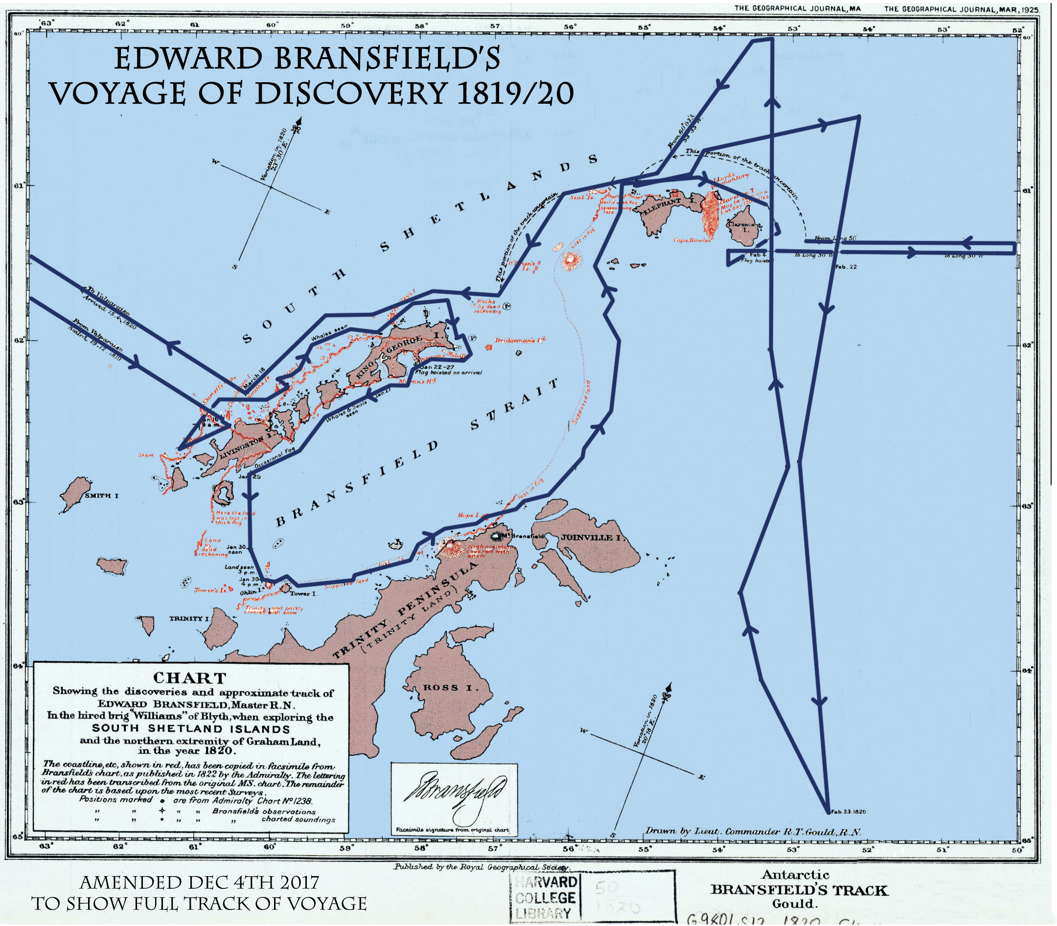
The first sight of land was made on 16th January 1820 as Bransfield ran along the South Shetland Islands seen by Smith a few months before. A small party went ashore on King George Island to formally claim the territory for Britain and Bransfield then turned south into the unknown seas.

This deep stretch of water, which is about 60 miles (96 K) wide and 300 miles (500 K) long, is today known as the Bransfield Strait and separates the South Shetlands from the Antarctic Peninsula.
On Sunday, 30th January 1820, one of Bransfield’s junior officers, Midshipman Poynter, who kept a personal log of the journey wrote:

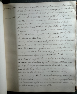
Image of the 30th January 1820 page entry in Midshipman Poynter’s Journal.

Courtesy of Alexander Turnbull Library
New Zealand

January 1820

Sunday, 30th

“At 3/4 past 3 on the ensuing Morning while standing to the Southward we made a Group of small Islands extending from SE to EbS. for the purpose of weathering them we shook out the 2nd reef of the Fore Topsail – Set the courses and bottom Mainsail close reefed, and while thus employed perceived Two Islands on the Weather bow – Without the possibility of being able to effect our design at 20 minutes after Four we Wore, the whole range stretching from EbN to SW. The Winds at this time were Strong and hazy Horizon which occasionally shut and opened to view an unknown Coast abounding with rocky Islets – At 8 The extremes of what we deemed the Main bore from SW to WbN and at 9 from North to SW Twenty minutes after we tacked to the Southward and at 1/2 past 11 set the Land WSW 3 and 4 Leagues – At Noon our Latitude by a Meridian Altitude was 630. 3′. 30″ Longitude by Chronometer 600. 25′. 30” W At 1/2 past 12 the Hazard thickening we Made more sail standing to the Southward and as it would appear by the bearing of the land at Noon away from it – At 3 our notice was atracted by Three very large Iceberges and 20 minutes after we were unexpectedly astonished by the discovery of land SbW-

He continues;

“…and immediately after this was discernable a high and rude range running in a NE and SW direction the centre of it bearing SE 6 or 7 Miles — a steep and roundish Island about 5 Miles distant SSW and a small circular Island SSW ½ W — the whole of these formed a Prospect not easily described ……”

Most significantly he added:

“Our theme of conversation was the idea of having by the direction of land took found what might possibly lead to the discovering of the long contested existence of a Southern Continent.”

This last statement is very powerful and shows they clearly understood the enormity of their discovery (unlike Bellingshausen) and it is probably the first time anyone suggested they may have discovered the Southern Continent.

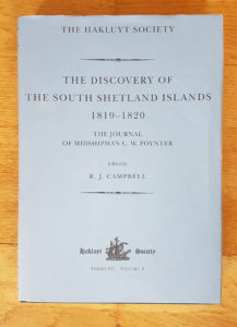
The Journal of Midshipman C.W. Poynter
(The Hakluyt Society 2000)

C. W. Poynter’s journal is the only surviving first-hand account of Bransfield’s historic voyage of discovery. It only came to light in the 1990s when it was discovered amongst the effects of an estate in Blenheim, New Zealand, originally belonging to the Clouston family and was bought by the Turnbull Library in New Zealand. It was subsequently reproduced by The Hakluyt Society 2000 (ISBN 0 904180 62 X)

For a detailed description of the journal, it’s history and Charles Poynter check out A.E.G. Jones’ 1997 paper.

Bransfield’s expedition had discovered a rocky chunk of the north-western shore of the Antarctic Peninsula which was named Trinity Land. A small nearby island was called Tower Island and in the distance the party could clearly make out an imposing snow-capped mountain. The 760m/2,500 ft peak is today named Mount Bransfield.

The Williams was rocked by gales and very rough seas over the following weeks as Bransfield and his crew endeavoured to extend their new discoveries. Occasionally, the ship broke into the Weddell Sea or ran along the eastern coast of the Peninsula and on 23th February 1820 the Williams reached 64° 56’ S. At one point, Williams steered close to charted some of the coastline of Elephant Island where, a century later, Shackleton’s men would be marooned after the sinking his ship, Endurance.

Bransfield turned north, (his decision partly made because some of his crew were dressed for Valparaiso weather and not the Antarctic weather for the whole trip!), and finished in Valparaiso on 16th April 1820 at the end of an epic and hugely challenging voyage. Not a single man was lost.

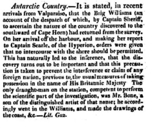
Carlisle Patriot, 19th August 1820

Few documents written by Edward Bransfield survive but one is a letter written by Edward Bransfield, dated 4th May 1820 in the Public Records Office of the Admiralty (London). This letter proves he handed over his log book and charts and also asked to be allowed go back to finish his work. His request was never granted and his log book is now lost.

“I beg leave to offer my services to finish it in the next Season, being of the opinion there is a great deal more to be done and as to its utility to Great Britain my log book will best explain’” Edward Bransfield, Valparaiso 4th May 1820.

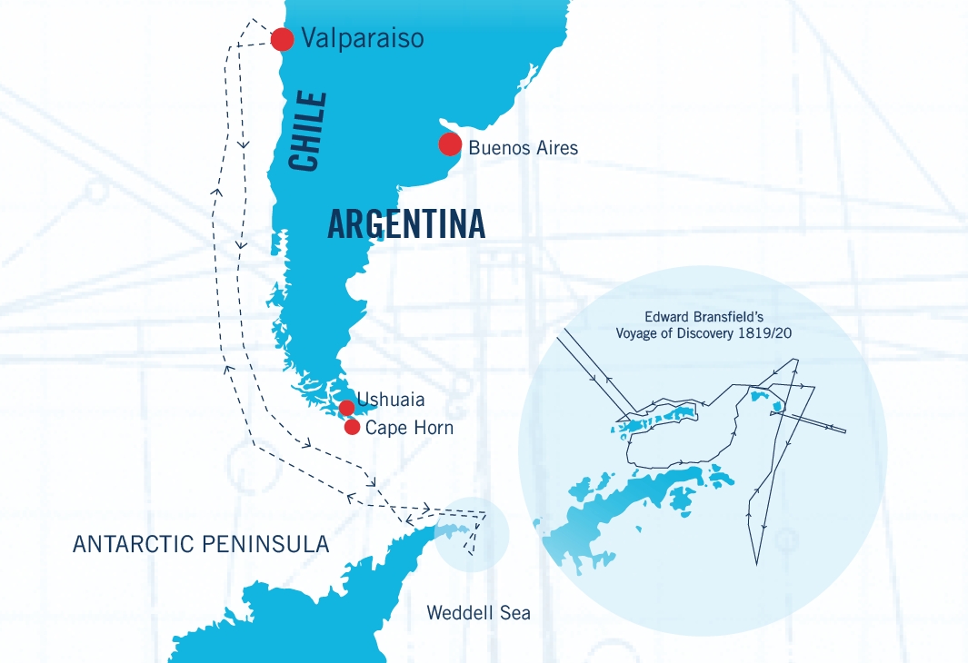
MAPS OF DISCOVERY

From Valparaiso to Antarctica

South Shetlands and Trinity Land

Edited version by Jim Wilson